Where Atmospheric Physics Meet Image Processing
The DeepSky system focuses on meeting high standards of analysis, quality, and validity. To achieve this, all the theories on Atmospheric Physics are exploited in combination with deep learning and image processing methods in order to obtain the best possible results.

Vision AI System
Novel system based on the technology of commercial cameras, combined with Computer Vision and deep learning techniques for the analysis of digital all-sky images.

Cost Efficiency
Innovation in reducing the cost of terrestrial measurements while maintaining quality and ease of use.

Visible and Infrared Spectrum
Combines visible and infrared images, estimates from propagation models and Vision AI, to provide geophysical variables, both day and night.
DeepSky Project Timeline
The main goal of the DeepSky project is to develop an innovative and flexible ground-based measurement system designed to address the needs of end-users in the meteorological, atmospheric and solar energy communities.
1.
Identify potential end-users, requirements, and market analysis
2.
DeepSky prototype development, calibration, and validation
3.
Algorithmic development for meteorological, atmospheric and solar measurements' processing of different geophysical variables
4.
Development of computer vision and deep learning techniques for cloud type identification, cloud coverage estimation and prediction
5.
System performance evaluation in real-world conditions
All-sky Visible Dataset
The dataset comprises a large number of more than 7000 sky images that have been annotated and classified to 7 cloud types. Additional multimodal data (like temperature, humidity, irradiance, particle pollution, etc.) and different periods of time (i.e., different months/years) have been considered in the training, resulting in an overall accuracy of more than 90%.
Complete Vision AI Infrastructure
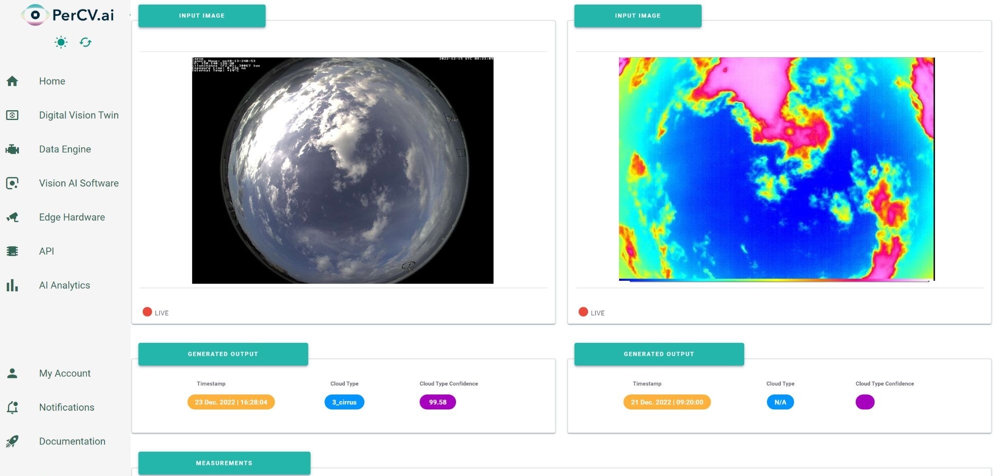
DeepSky is integrated with PerCV.ai, Irida Labs’ end-to-end software and services platform for deploying Vision AI at scale.

Our Role
Computer vision and deep learning techniques for the analysis of digital all-sky images (cloud types and cloud coverage, cloud prediction etc.)
Contact Us

Funding Details
This project has been co-financed by the EU and National funds through the Operational Program Competitiveness, Entrepreneurship and Innovation, under the call RESEARCH – CREATE – INNOVATE, project no. Τ2ΕΔΚ-00681


